21 Breathtaking Lake Tahoe Hiking Trails
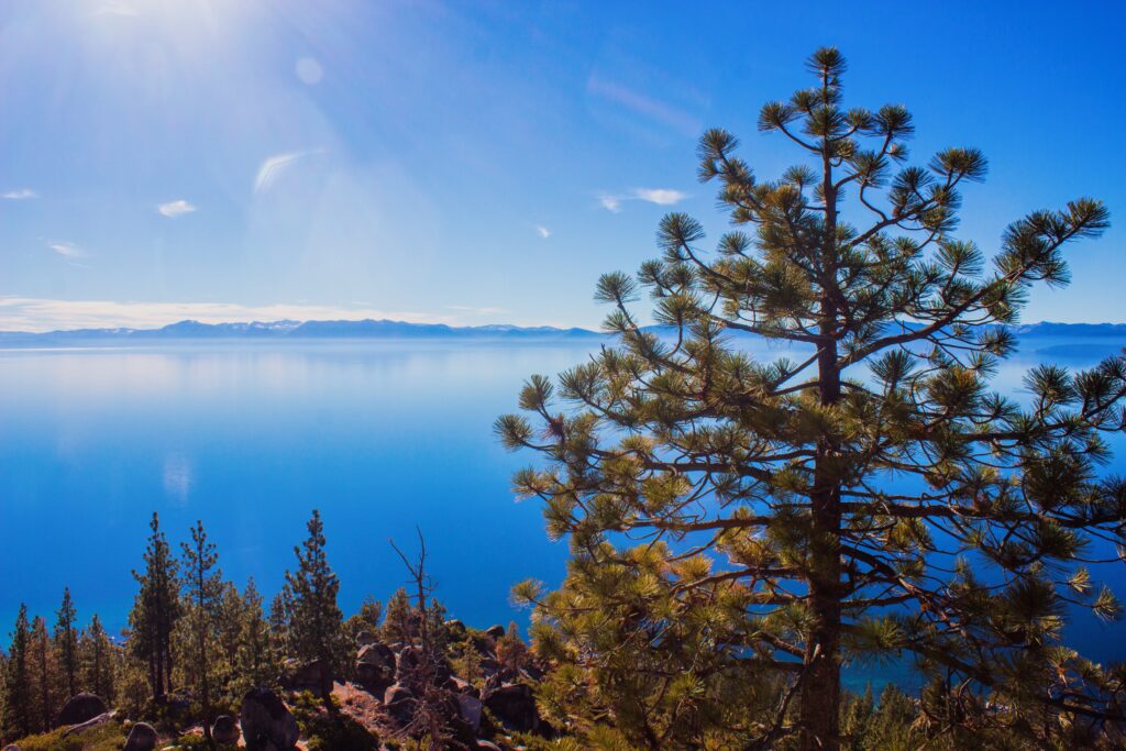
From the crystal blue waters on the east shore to the high alpine lakes in Desolation Wilderness near the west shore to gentle meadow strolls in the north to high granite peaks in the south, you won’t be disappointed by these impressive Lake Tahoe hiking trails.
Whether you’re an avid hiker, planning your first solo hike, or enjoying a gentle family-friendly stroll, there are plenty of Lake Tahoe hiking trails to choose from.
Lake Tahoe Fun Facts
- Lake Tahoe Elevation: Lake Tahoe sits at 6,225 feet in elevation and is the largest alpine lake in the US.
- Lake Tahoe Depth: Reaching 1,645 feet deep, Lake Tahoe is the second deepest lake in the US after Crater Lake in Oregon.
- The perimeter of Lake Tahoe is 72 miles around. The lake’s dimensions are 22 miles by 12 miles.
- Lake Tahoe is filled with 39 trillion gallons of water. That’s enough water to cover all of California over 14 inches deep.
- 63 sources of water, flowing from streams and creeks, flow into Lake Tahoe but there’s only one outlet from Lake Tahoe: the Truckee River.
Where is Lake Tahoe?
Located in the northern part of the Sierra Nevada Mountains, Lake Tahoe sits on the California-Nevada border. One-third of Lake Tahoe lies in Nevada and two-thirds in California.
Lake Tahoe is about a three-and-a-half-hour drive from San Francisco, an hour and a half drive from Sacramento, and less than an hour from Reno, Nevada.
Lake Tahoe is located near many of California’s natural wonders. Combine your visit to Lake Tahoe with a road trip to Yosemite National Park, Lassen Volcanic National Park, Mammoth Lakes, or Wine Country.
When to Go Hiking in Lake Tahoe
You can explore the Lake Tahoe hiking trails all throughout the year, however, each season brings different experiences. Lake Tahoe hikes are busiest in the summer between Memorial Day to Labor Day.
Spring
Spring in Lake Tahoe brings rushing waterfalls and blooming wildflowers.
While you can usually start hiking some trails in the spring, it depends on the snowpack. Some years trails are snow-free by May. In other years, like this past 2023 season, the snowpack is melting very slowly.
Summer
By the middle of summer, many lower-elevation Lake Tahoe hiking trails are free of snow. As summer goes on and snow continues to melt, you can hike up higher peaks with minimal to little snow.
**This past 2023 winter season brought the most snowfall on record. Because of this, we are still seeing a lot of snow well into the end of June. Expect late meltings this 2023 Lake Tahoe hiking season.
Fall
Fall in Lake Tahoe brings cool autumn temperatures with the aspen trees turning bright yellow, a beautiful contrast to the forest-green pine trees.
It’s a great time to hike as trails are free of snow. Unfortunately, depending on the year, the fall in Lake Tahoe can be blanketed in smoke from wildfires. Follow the news for the most up-to-date fire conditions.
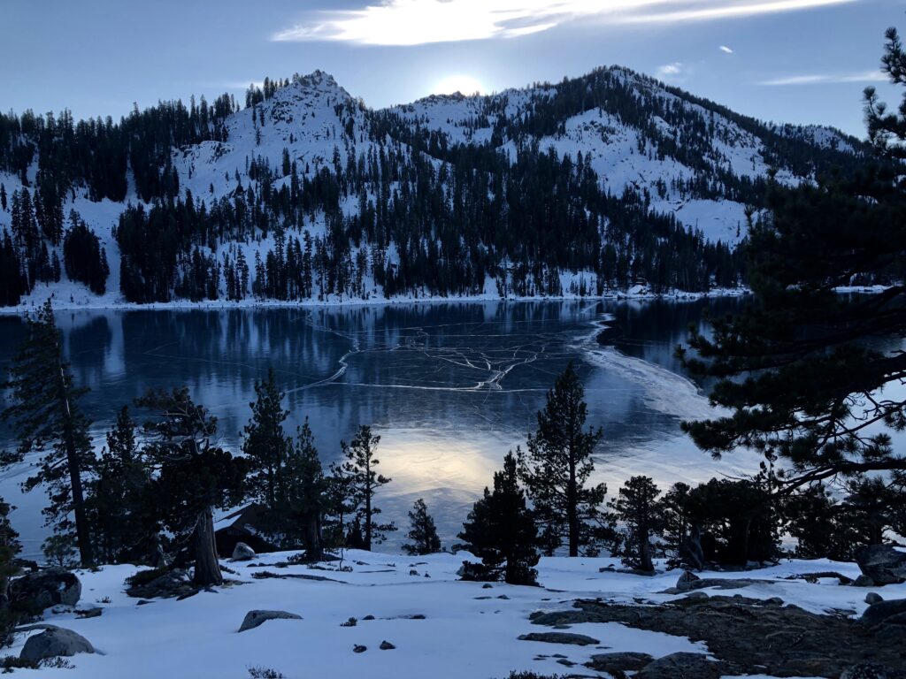
Winter
You might not pin Lake Tahoe as a winter hiking destination. While many folks come to Lake Tahoe to ski in the winter, snowshoeing Lake Tahoe is a popular option for hikers!
Expect a lot of snow on all trails, especially at higher elevations. I love snowshoeing in the winter but it’s important to know your limits and understand avalanche conditions. If you’re unsure, book a guided Lake Tahoe snowshoeing tour with Tahoe Adventure Company!
Lake Tahoe Hiking Trails Map
A map of the Lake Tahoe hiking trails.
How to Prepare for Lake Tahoe Elevation

Sitting at 6,225 feet, the elevation of Lake Tahoe takes some getting used to, especially if you’re arriving from sea level.
While severe altitude sickness usually doesn’t start till around 8,000 feet, it’s not uncommon to start feeling the effects of altitude when arriving at the lake. You might feel out of breath while walking upstairs or ascending a small hill.
How to prepare for Lake Tahoe Elevation:
- Plan a relaxing first and second day after arriving
- Drink plenty of water while in Lake Tahoe and prior to arriving
- Continue eating meals – carbs are good; make sure you take in a balanced amount of salts and sugars – try electrolytes
- If you feel nauseous, dizzy, tired, or have a headache: rest and minimize physical activities while you adjust
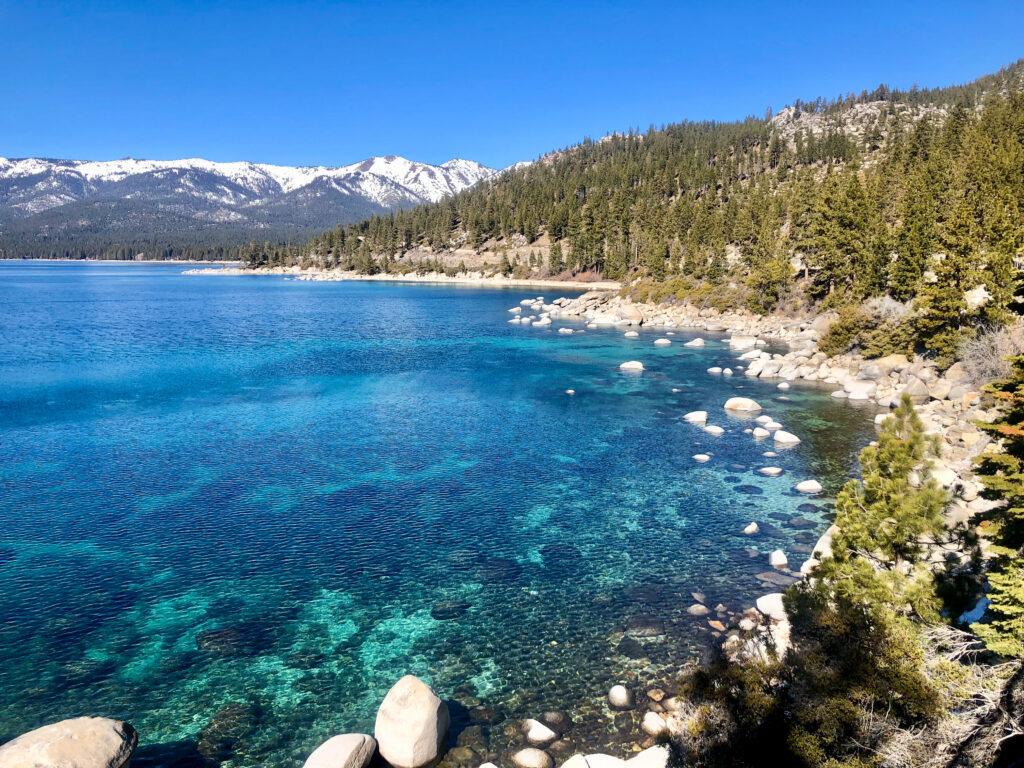
Best East Shore Lake Tahoe Hiking Trails
Lakes Tahoe’s east shore is the least developed area around Lake Tahoe. Just south of Incline Village down to Zephyr Cove, the shoreline has very minimal development.
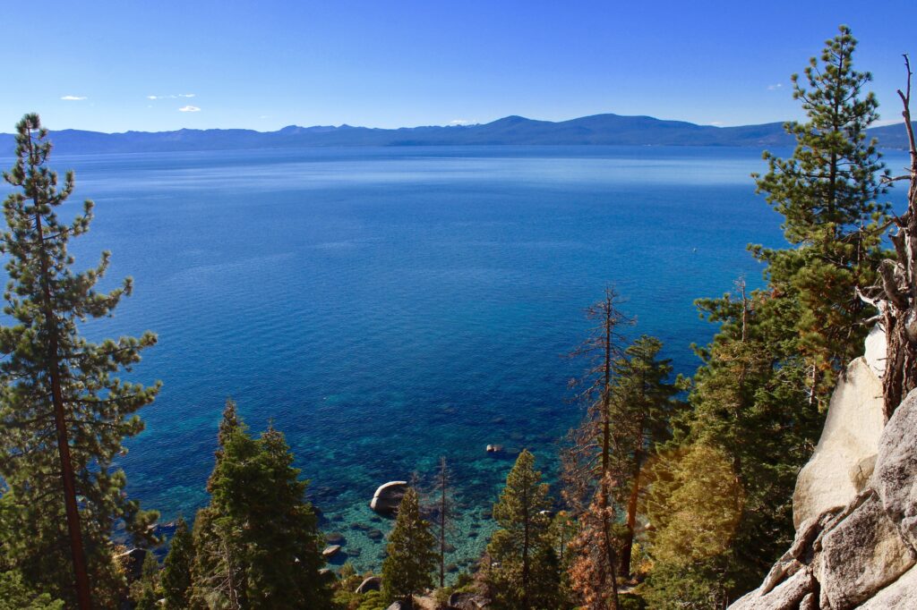
Therefore, it’s home to some of the clearest bright blue water around the lake and offers the opportunity for hiking and biking for all abilities.
Monkey Rock
2.5 miles out & back; 500 foot gain; moderate
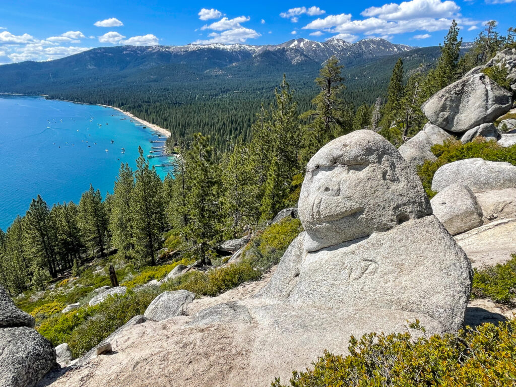
There are few rocks around the Lake Tahoe Basin more iconic than Monkey Rock. The trailhead starts just behind the Tunnel Creek Cafe – a great brunch spot to check out!
The ascent to Monkey Rock starts on pavement and is relatively gradual for the first mile. It follows high alongside the lake surrounded by Manzanita bushes and Jeffrey Pines. Then the trail rounds east continuing into the forest for a few minutes before the steep climb begins.
The climb is short but very steep. You’ll reach about 6,700 feet in elevation, about 500 feet above Lake Tahoe. The climb will take your breath away but the views from the top along the Tahoe East Shore are worth it and you’ll be greeted by the stone monkey sitting atop.
Chickadee Ridge
2.5 miles out & back; 270 foot gain; easy-moderate
Chickadee Ridge is located right off Mount Rose Highway. The trail starts at 8,500 feet and climbs to 8,700 feet. While the ascent is gradual and mellow, I rate it as easy-moderate because it’s at a high elevation which is particularly challenging if you’re not acclimated.
Because Chickadee Ridge is farther out from the basin, it’s a bit less popular than other Lake Tahoe hiking trails. From Chickadee Ridge enjoy impressive views of Lake Tahoe from a birds-eye view and watch the Chickadees swarm the horizon!
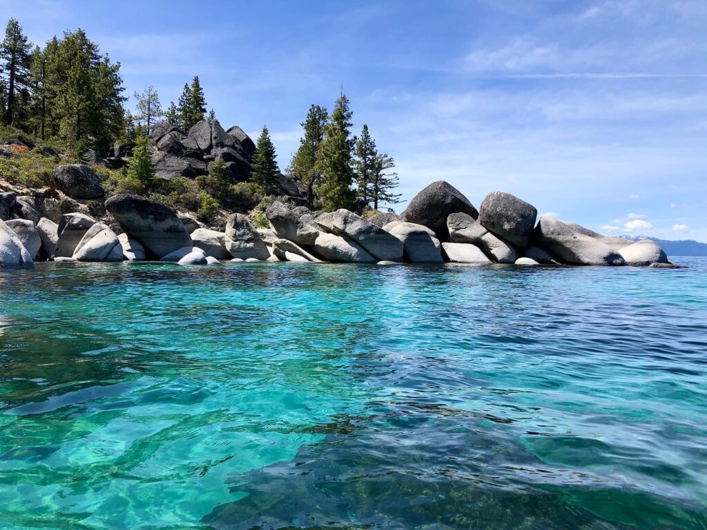
East Shore Trail
2.5 miles one way, 150 foot gain, easy – flat & paved
The East Shore Trail starts in Incline Village at the Tunnel Creek Cafe and follows along the edge of Lake Tahoe. These are some of the brightest blue shore waters around the lake!
The path is paved and runs about 2.5 miles from parking at the cafe to Sand Harbor State Park. It’s a great spot to run, walk, or ride a bike and a great option to avoid the limited parking in Sand Harbor. You can rent bikes next to the Tunnel Creek Cafe at Flume Trail Bikes.
Of all the Lake Tahoe hiking trails the East Shore Trail is one of the most accessible for all hiking abilities.
Flume Trail
14 miles one way; 1400 foot gain; moderate-strenuous
The Flume Trail is a 14-mile point-to-point trail along the east shore of Lake Tahoe. While the Flume Trail is one of the scenic Lake Tahoe hikes, it’s even more popular for mountain biking or hiking in sections. Once again you can rent mountain bikes from Flume Trail Bikes.
The Flume Trail starts (or ends) at the Tunnel Creek Cafe. Hop on the trail heading in the direction of Monkey Rock then continue along Tunnel Creek Road to Marlette Lake and then on to Spooner Lake. From there you can hike back or park a car ahead of time to drive back.
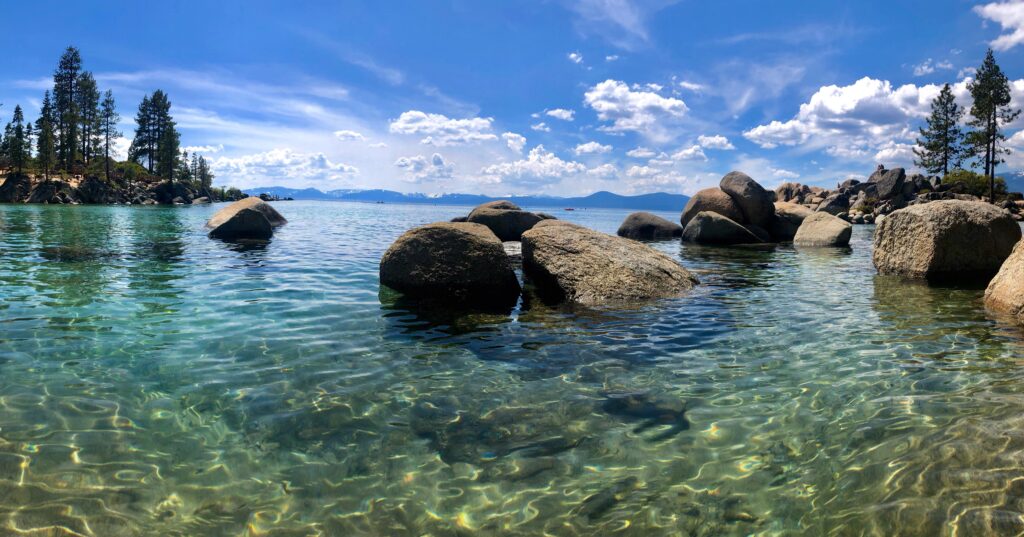
Sand Harbor Nature Trail
0.5-mile loop, flat, easy
Sand Harbor State Park is home to one of my favorite beaches around Lake Tahoe. It’s simply breathtaking – the clearest bright blue water. You can easily see 40 feet deep if you’re kayaking here.
It’s one of the most photographed spots around Lake Tahoe with the giant boulders popping out of the water off the coast of the beach.
Follow the wooden boardwalk to learn about the local geology and history along the Sand Harbor Nature Trail. The Shakespeare Amphitheater sits in the center of the trail where plays occur throughout the summer.
After walking the Sand Harbor Nature Trail, relax on the beach, rent a kayak and paddle among the boulders, or go for a swim in the late summer!
Best North Lake Tahoe Hiking Trails
The area immediately north of Lake Tahoe is surrounded by a few cities including Tahoe City and Kings Beach. Just north of there along Highway 267 and Highway 89 are a variety of hikes with varying elevation gains and difficulties.
Point Mariah
5 miles out & back; 600 foot gain; easy-moderate
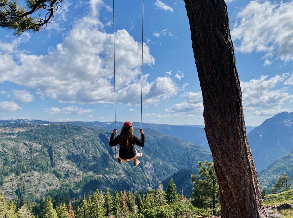
A giant swing sitting above the deep Sterling Canyon surrounded by high mountain peaks with waterfalls flowing down into the American River?! Who knew something was so close to Lake Tahoe?
Point Mariah is one of my favorite Lake Tahoe hiking trails and it’s located off the beaten path. And it’s a pretty easy hike. At 5 miles round trip it only gains about 600 feet in elevation. The trail is wide in most parts and the gain is gradual. I love this hike because the views are so different than the hikes surrounding Lake Tahoe, and certainly worth it!
Castle Peak
5.5 miles out & back, 1750 foot gain; strenuous
Castle Peak sits a bit north of the Lake Tahoe Basin. It gets its name for its distant appearance of a castle on the horizon. Located right off Highway 80 before reaching Donner Pass, the hike up to Castle Peak is one where you’ll feel a bit of altitude again.
The trail starts out gradually along a rocky forest road. As you continue higher it narrows and reaches a ridge that looks out on Emigrant Wilderness to the north and out at Northstar and Granite Chief Wilderness to the south.
Eventually, the trail gets steeper and rockier so watch your footing. When you reach the saddle continue right, along the ridge to Castle Peak. This is one of the most popular backcountry ski spots near Lake Tahoe and during low snow years, hiking around the meadows below Castle Peak makes for a great winter hike or Lake Tahoe snowshoe.
Granite Chief Trail
6.7 miles out & back; 1960 foot gain; challenging
Located right next to Palisades Ski Reost, climb high along the Washeshu Creek ascending into the alpine and into Granite Chief Wilderness. The trailhead begins at the Palisades Ski Resort.
The Granite Chief Trail climbs almost 2000 feet before connecting with the Pacific Crest Trail. It’s a steep climb at altitude reaching about 8,200 feet but the views from the ridge are stunning. From the top, you can look out on the ski resort and all throughout Granite Chief Wilderness.
Martis Valley
1 – 5 miles out & back or round trip; flat; easy
If you’re looking through a gentle stroll through some meadows and a Jeffrey pine forest, then a walk through Martis Valley is a great option. It’s one of the most accessible Lake Tahoe hikes for any hiking level.
Walk amongst flowing creeks, wildflowers, sagebrush, and manzanita bushes. The trail starts and finishes along a bike bath but before you know it you’re on a trail crossing streams and wandering through the dense forests.
Martis Peak Fire Lookout
9.2 miles out & back, 1900 foot gain, strenuous
Climb from Brockway Summit on Route 267 up to the summit of Martis Peak, one of the highest peaks on the north side of the Lake Tahoe Basin.
The round-trip hike is about 9 miles and gains almost 2000 feet in elevation. It’s not the easiest but the panoramic summit views of Lake Tahoe and the surrounding forest are well worth it. And you can hang out in the Martis Peak Fire Lookout and enjoy a picnic lunch!
Best West Shore Lake Tahoe Hiking Trails
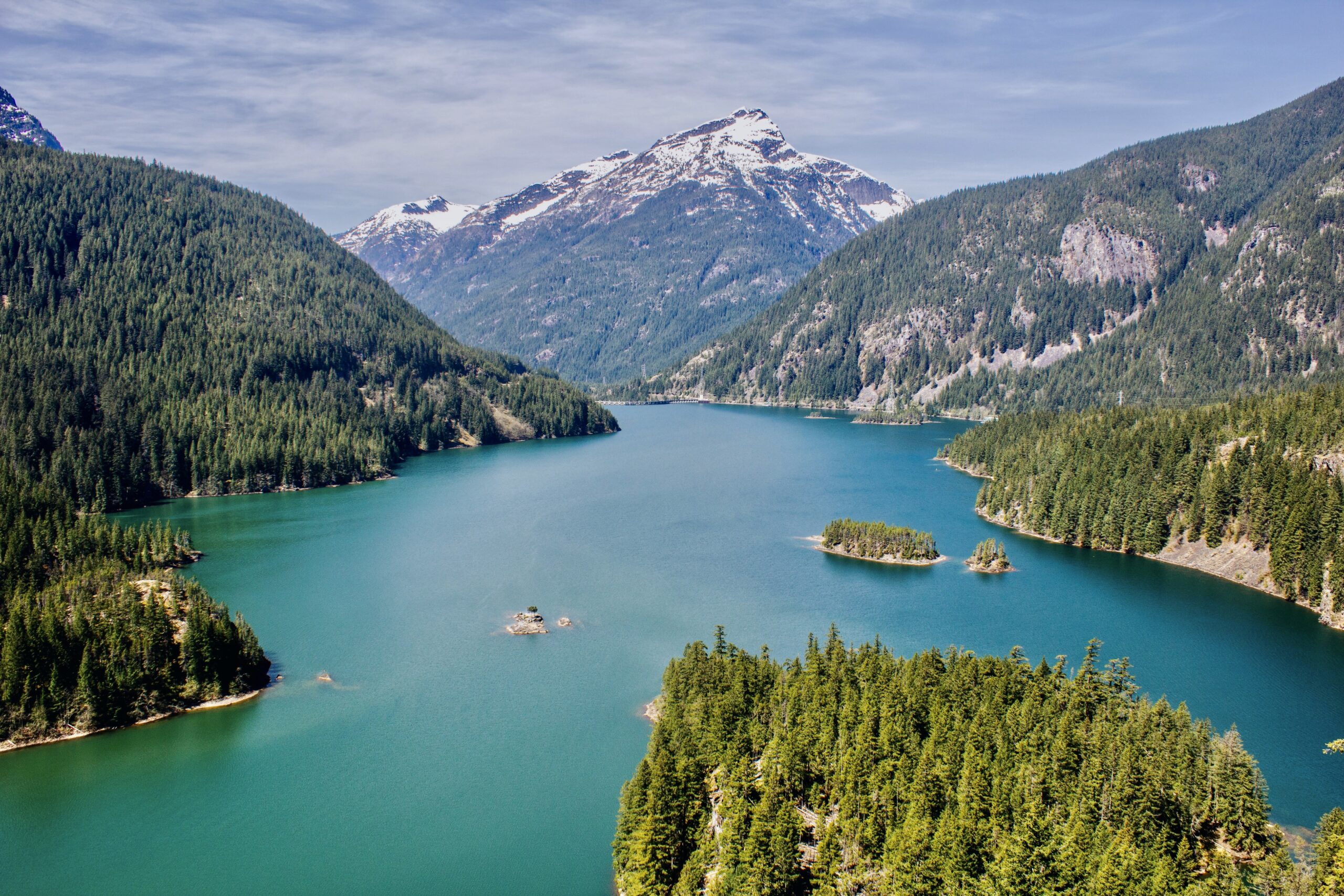
The west shore of Lake Tahoe includes Desolation Wilderness and Emerald Bay State Park. The north part of the west shore is a bit developed but as you continue south you can hike to some of the most pristine alpine lakes in the region!
Rubicon Trail
1 – 18 miles one way; flat – 1800 foot gain; easy-strenuous
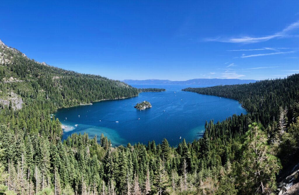
The Rubicon Trail is one of the most popular Lake Tahoe hikes for families. Hike just a mile or two down to Emerald Bay or continue to climb one up into the mountains or along the lake through D.L Bliss State Park. The path down to the lake is paved and is a popular family-friendly hike.
Note that the paved stretch down to the water descends about 400 feet in elevation down to Lake Tahoe which means you’ll have to climb up the 400 feet to leave.
At the water, you can rent kayaks and kayak around Emerald Bay or check out the history of Vickingsholm, a historical 38-room mansion featuring Scandinavian architecture. Vickingsholm is listed on the US National Register of Historic Places and is quite a unique Lake Tahoe site to check out.
Eagle Lake Trail
2 miles out & back; 460 foot gain; easy-moderate
Eagle Lake is one of my favorite Lake Tahoe hiking trails. The trail starts just above Emerald Bay and heads back to the high alpine lake, Eagle Lake, located in Desolation Wilderness.
Along the way, you pass Eagle Falls which is roaring in the spring and early summer as snow melts. The trail continues winding through the pines with views opening up to Lake Tahoe and Emerald Bay. By the time you reach Eagle Lake, it’s surrounded by the high peaks in Desolation Wilderness.
Echo Lakes
5.3 miles out & back, 500 foot gain; moderate
Echos Lakes is a beautiful trail that enters into Desolation Wilderness. The trail starts bordering the side of Lower Echo Lake offering views of Flagpole Peak, Talking Mountain, and Becker Peak.
The trail continues along eventually reaching Upper Echo Lake. Overall, the 5-mile round trip hike only gains 500 feet in elevation so it’s very moderate.
Echo Lakes is also one of my favorite Lake Tahoe hiking trails to visit in the winter. It’s also a beautiful spot to snowshoe.
Lake Aloha
12.5 miles out & back, 1900 foot gain; strenuous
Lake Aloha is one of the most popular Lake Tahoe hiking trails located in Desolation Wilderness. The hike to Lake Aloha is often done as a long day or a one-night backpacking trip.
Surrounded by the high granite peaks, the views from Lake Aloha are breathtaking. The pristine alpine lake is a great swimming spot. Along the hike, you’ll also pass by Lower and Upper Echo Lakes, and Tamarack Lakes, and there’s the option to extend the trail slightly to hike to Lake of the Woods.
Cascade Falls Trail
1.3 miles out & back; 200 foot gain; easy
Cascade Falls Trail is one of the easiest Lake Tahoe hikes near South Lake Tahoe, located near Desolation Wilderness. The trail starts from Bayview Camp, just across from the lookout, Inspiration Point, at Emerald Bay State Park.
From there the Cascade Falls Trail follows a ridge above Cascade Lake out to the falls. After the gradual ascent over about a half mile, you’ll reach Cascade Falls which flows down the smooth granite rock and down into the Cascade Lake.
Cascade Falls are one of the classic Lake Tahoe hikes showcasing the roaring waterfalls that flow strongest from late spring into early summer.
Fallen Leaf Lake
3.5 miles out & back; 140 foot gain; easy
The Fallen Leaf Lake Trail is a mellow stroll around Fallen Leaf Lake. Starting at Fallen Leaf Campground, walk a mile or two from the campground around the south side of the lake.
The trail is pretty gentle with less than 140 feet of elevation gain making it a great Lake Tahoe hiking trail for all visitors. Along the trail, you’ll walk among the large pines, some of the older ones in the Lake Tahoe Basin, while taking in sites of the high granite peaks.
Mount Tallac
10.5 miles out & back; 3300 foot gain; challenging
Mount Tallac is one of the tallest peaks in the Lake Tahoe Basin and the tallest point in Desolation Wilderness. It offers the highest panoramic views along Lake Tahoe’s west shore. Mount Tallac is one of the best Lake Tahoe hiking trails if you’re planning strenuous a full-day hike.
The Mount Tallac Trail is a long hike and at such a high altitude above Lake Tahoe, give yourself proper time to acclimate and don’t rush the ascent.
The trail starts very gradually passing through the forest by Fallen Leaf Lake. A couple of miles into the ascent the blocky steps begin, and as you continue it gets rockier! By the time you reach the summit, you’ll scramble across a bit of some medium size rocks to the widespread vistas.
From the summit, you’ll have views of the high peaks of Desolation Wilderness and sites looking down on Lake Tahoe and Emerald Bay. It’s well worth the tough ascent.
Best South Lake Tahoe Hiking Trails
South Lake Tahoe is one of the most trafficked areas around Lake Tahoe but that doesn’t mean there are no hiking opportunities! South Lake is also the mid-point between Desolation Wilderness and the east shore if you’re looking for more options.
Castle Rock
1.6 miles out & back; 600 foot gain; moderate
Castle Rock is one of the best South Lake Tahoe hiking trails. It’s located close to South Lake Tahoe and offers impressive views looking down on the town of South Lake and out to the beaches across the west shore and the whole lake.
This trail starts up higher winding through the ponderosa pines as you make your way out to the viewpoint. The top of Castle Rock features jagged rocks that require a bit of scrambling. Castle Rock is also a popular rock climbing. On a sunny day, the water of Lake Tahoe shines impressively bright.
Cave Rock
0.8 miles; 150 foot gain; easy
Driving around the southeastern side of Lake Tahoe you’ll pass under a large rock cave carved out, Cave Rock. The Cave Rock Trail is one of the shortest Lake Tahoe hiking trails that offers impressive views of Lake Tahoe.
The round-trip hike is located just north of South Lake Tahoe, right off the highway making it easily accessible with a short distance and minimal elevation gain.
Lake Tahoe Backpacking Trails
Lake Tahoe is also well-known for its backpacking options! There are many 1-night options to trails that will keep you busy for a couple of weeks!
Round Top & Fourth of July Lake Loop
15 mile loop; 3300 foot gain; 1 – 3 days; challenging
Head south of Lake Tahoe into Mokelumne National Forest to explore Round Top Peak and hike the Fourth of July Lake Loop. Along the way, you’ll pass Lake Winnemucca and other lakes.
This loop is commonly done as a 2 – 3 day backpacking trip with a few intersecting trails to choose your preferred route. Add in the summit of Round Top or stick to the main trails.
Tahoe Rim Trail
The Tahoe Rim Trail is a 170-mile trail that circles around Lake Tahoe climbing up and down ridgelines and peaks, crossing streams, and passing through towns.
The trail is a tough one gaining and losing about 23,000 feet of elevation. Some people complete it in as short as a week but most people backpack the Tahoe Rim Trail in 10 – 15 days.
Desolation Wilderness
Desolation Wilderness is known for its pristine alpine lakes. It’s a busy spot for backpacking in Lake Tahoe as there are a variety of routes that overlap and cross.
You can hike to over 20 lakes in a few days depending on the route you plan! It’s also a spot to bag some peaks, some that follow trails, and others that require off-trail travel and scrambling!
Lake Tahoe Hikes Packing List
When hitting the Lake Tahoe hiking trails it’s important to make sure you’re properly packed. With the varying Lake Tahoe elevations, depending on where you’re hiking, expect a range of temperatures.
Layers are always important as well as sun protection and a way to stay warm. And of course, the hiking essentials.
- Clothing layers – puffy jacket, rain jacket, warm base layer
- Comfortable hiking boots or trail runners
- Quick-drying hiking pants
- Long-sleeved sun hoodie
- Day hiking backpack 18 – 30 liters
- Trekking poles
- Gloves
- Sun hat
- Warm hat
- Sunglasses
- Headlamp
- Road maps – downloaded offline & paper
- First aid kit – blister care, over-the-counter meds (Ibuprofen, Acetopmetafin, Benadryl), bandaids, gauze, medical tape, medical scissors, antibiotic ointment (like Neosporin)
- Snacks
- Water
- Water filter
- Bug spray
- Sunblock
- Garmin InReach Mini
- Pocket knife
- Topo map